Atlas Maps
General Maps
Ground Plans
Overview Maps
Ronen Schmitz Even Zur
Cartography

Cartographic Catalogue
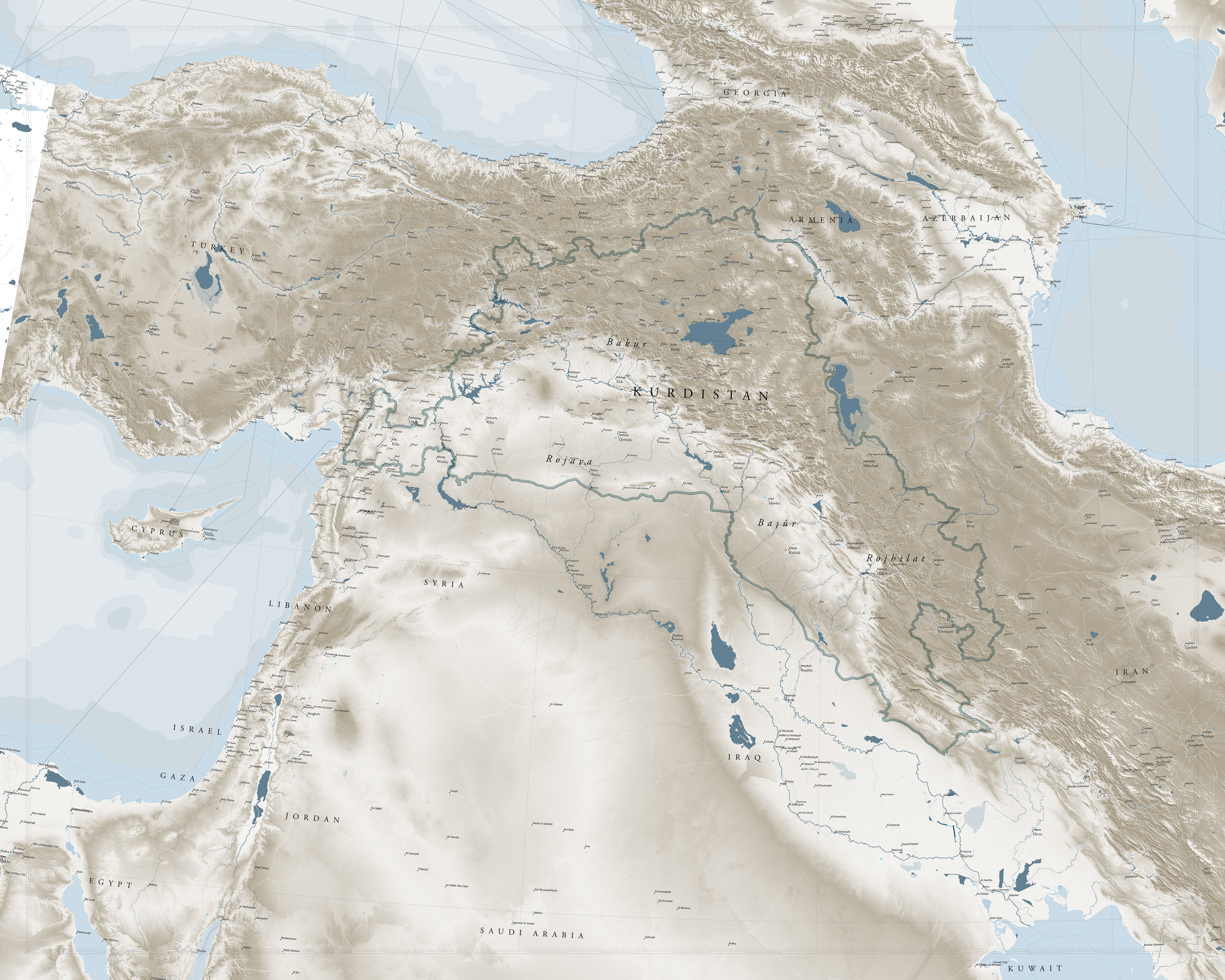
Kurdistan Atlas Map L Version
1 : 500.000
January 2019
January 2019

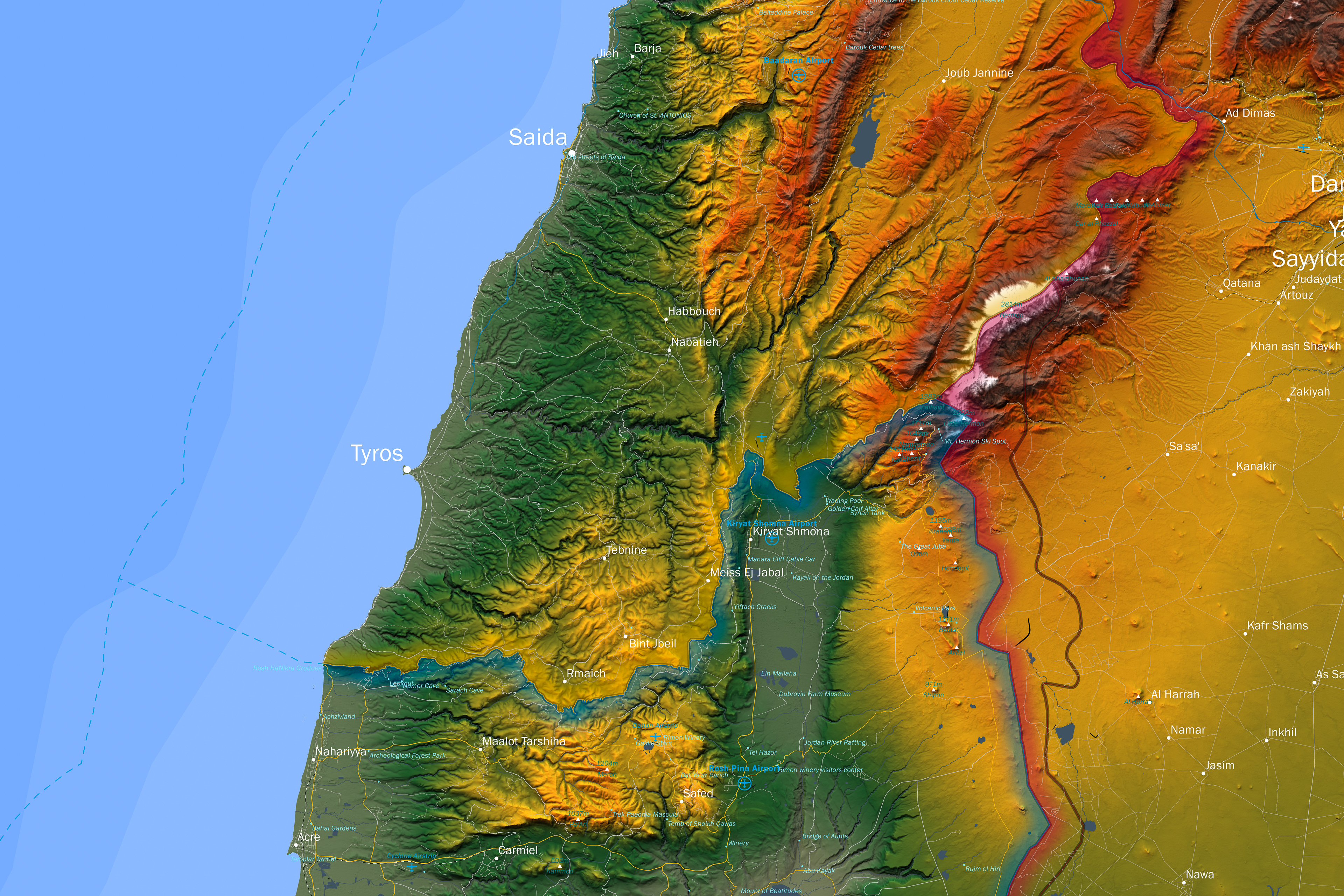
Israel Atlas Map
1 : 500.000
January 2018
January 2018
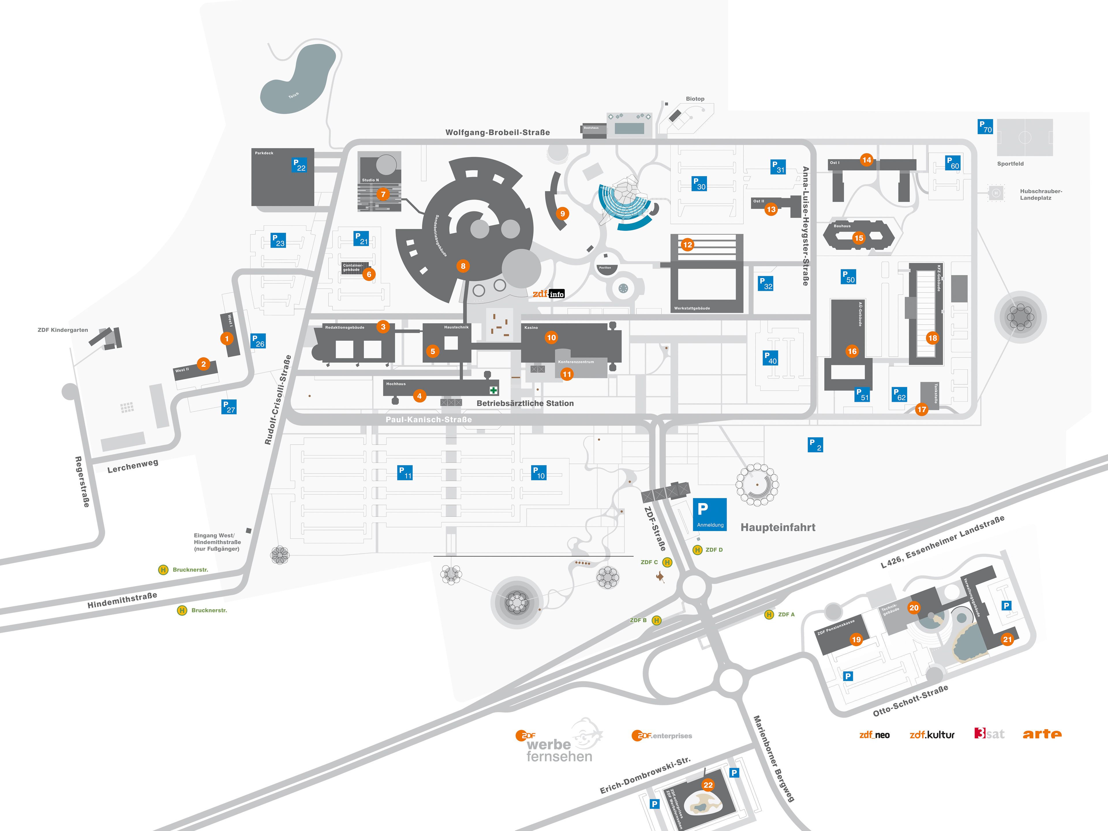
ZDF Grounds Overview Plan
1 : 25.000
February 2006
February 2006